
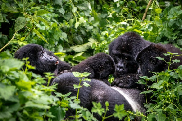
The park lies in Kisoro District in southwestern Uganda, near the Rwanda and Democratic Republic of Congo borders. It forms Uganda's portion of the wider Virunga conservation landscape.
Introduction
Where Is Mgahinga on the Uganda Map?
Mgahinga Gorilla National Park is located in the extreme southwest of Uganda. On a national map, it sits far from Kampala and Entebbe, close to Kisoro town. The park lies near the corner where Uganda approaches both Rwanda and the Democratic Republic of Congo.
Mgahinga and Kisoro
Kisoro is the main town serving the park. A Mgahinga map usually shows Kisoro just outside the protected area. The town provides:
- Accommodation - Banks - Shops - Fuel - Restaurants - Medical services - Transport connections - Access to the wider Virunga region
Many budget and mid-range travelers stay in Kisoro. Others choose safari lodges closer to the park.
The Virunga Volcanoes
Three major volcanoes dominate the Mgahinga landscape.
- Mount Muhabura - Mount Gahinga - Mount Sabyinyo
These mountains are among the most important landmarks on any map of the park. They help define hiking routes, vegetation zones and the broader geography of the Virunga ecosystem. Each mountain offers a different character.
Muhabura is known for its prominent cone. Gahinga forms another major peak. Sabyinyo has a distinctive jagged profile.
Uganda, Rwanda and DR Congo
One of the most interesting features of the Mgahinga map is the proximity of three countries. Uganda lies to the north and east of the local international boundaries. Rwanda lies to the south.
Mgahinga and the Greater Virunga Ecosystem
Mgahinga is part of a larger mountain conservation landscape. This wider ecosystem includes protected forest on the Rwanda and Democratic Republic of Congo sides of the Virunga Mountains. The transboundary geography is important for mountain gorilla conservation.
It also explains why visitors frequently combine Uganda and Rwanda in one safari. However, cross-border travel requires immigration procedures and cannot be treated like simply driving from one side of a park to another.
Park Entrances and Activity Areas
Visitors do not independently enter random sections of Mgahinga. Activities begin from designated park areas according to current management procedures. Gorilla trekking, golden monkey tracking and volcano hiking each involve registration and briefing.
The exact starting location should be confirmed in your safari itinerary. A map is useful for general orientation, but it does not replace instructions from Uganda Wildlife Authority or your guide.
Gorilla Trekking Areas
Mountain gorillas move naturally within their habitat. A map cannot show exactly where the gorillas will be on trekking day. Trackers monitor them and guide visitors from the designated starting area.
Golden Monkey Areas
Golden monkeys are strongly associated with the bamboo zones of Mgahinga. A vegetation map can therefore help explain why certain areas are particularly important for this primate. However, the monkeys also move.
Visitors follow ranger guides rather than navigating to a fixed point. The bamboo habitat is distributed according to altitude and ecological conditions rather than tourism boundaries.
Mount Muhabura on the Map
Mount Muhabura is one of the easiest Virunga peaks to recognize. It rises prominently on the Uganda–Rwanda side of the park landscape. The hiking route involves substantial elevation gain.
Mount Gahinga on the Map
Mount Gahinga sits between other major Virunga peaks. Its position makes it central to the visual landscape of Mgahinga. Travelers hiking the mountain pass through vegetation zones influenced by elevation.
Topographic maps can help explain these changes. However, hikers should never attempt independent navigation. All formal hiking activities require appropriate park arrangements and guides.
Mount Sabyinyo on the Map
Mount Sabyinyo is particularly interesting geographically because of its location near the international meeting area of Uganda, Rwanda and the Democratic Republic of Congo. Its rugged profile appears very different from smoother volcanic cones. The mountain's geography is one reason the hike is considered challenging.
Visitors must remain with authorized guides and respect all international boundary instructions.
Mgahinga and Bwindi Map
Bwindi Impenetrable National Park lies northwest of the Mgahinga region. The two parks are close enough to combine within one safari but not so close that travelers should ignore road conditions. Bwindi has several trekking sectors.
Rushaga and Nkuringo
The southern Bwindi areas of Rushaga and Nkuringo are particularly relevant to travelers combining Bwindi with Mgahinga. A regional map shows that they lie within the broader southwestern highland region. However, mountainous roads mean travel times can be slower than expected.
Do not judge the route solely by straight-line distance. Your itinerary should use realistic local driving estimates.
Mgahinga and Lake Mutanda
Lake Mutanda lies within the wider Kisoro landscape and is sometimes used as an accommodation or relaxation base. A regional Mgahinga map shows its relationship with Kisoro, the Virunga volcanoes and southern Bwindi. Travelers may include a lake stay before or after gorilla trekking.
Mgahinga and Lake Bunyonyi
Lake Bunyonyi lies farther east within southwestern Uganda. It can be included as a relaxation stop before or after Mgahinga. The road connection allows travelers to combine mountain activities with a lake experience.
Mgahinga and Queen Elizabeth National Park
Queen Elizabeth National Park lies north of the Mgahinga region. Travelers commonly connect the two destinations by road. Depending on the route, the journey may pass through southwestern highlands and areas associated with Bwindi.
Mgahinga and Kibale National Park
Kibale lies farther north. A longer Uganda safari may continue from Mgahinga through Queen Elizabeth toward Kibale. This creates a classic primate itinerary combining:
A national map shows the logical north–south progression. However, sufficient days are necessary. Trying to cover all destinations too quickly results in excessive driving.
Mgahinga and Lake Mburo
Lake Mburo National Park can serve as a useful stop between southwestern Uganda and Kampala or Entebbe. On a Uganda map, it lies along the broader route back toward central Uganda. Including Lake Mburo can break a long drive and add game viewing.
Travelers may see zebras, antelopes and other savannah wildlife after several days in mountain forest.
Road From Kampala to Mgahinga
The road journey from Kampala or Entebbe to Mgahinga is long. The route generally travels southwest through major towns before reaching the highlands around Kabale and Kisoro. Exact road choice depends on current conditions and itinerary.
Travelers should treat the journey as a full safari travel day or divide it with another destination. A private 4x4 vehicle provides flexibility.
Flying to the Mgahinga Region
Domestic flights can reduce the amount of road travel. Depending on current schedules, travelers may fly toward the Kisoro region and continue by road. A map helps illustrate how much distance this saves compared with driving from Entebbe.
However, flights do not eliminate ground transfers. Travelers still need transport between the airstrip, lodge and park.
Mgahinga From Kigali
Kigali lies south-east of the Mgahinga region across the Rwanda–Uganda border. On a regional map, the distance appears relatively manageable. This makes Kigali a practical arrival or departure point for some itineraries.
However, the international border changes the logistics. Travelers must allow time for immigration, vehicle arrangements and any current entry requirements.
Border Crossings
Do not rely solely on a digital map when planning cross-border travel. Maps may display small roads or crossings that are not appropriate for tourists. Use current official information and guidance from your safari operator.
Operating hours, immigration requirements and vehicle rules can change. The itinerary should specify the intended border crossing clearly.
Topographic Maps
A topographic Mgahinga map is especially useful for understanding volcano hiking. Contour lines show steepness. Closer contour lines indicate steeper terrain.
Vegetation Maps
Vegetation maps divide the park into different ecological zones. These can include bamboo, montane forest and higher-altitude vegetation. Such maps help explain wildlife distribution.
Accommodation Maps
A lodge map can help travelers compare:
Never choose accommodation based only on a generic pin. Ask how long the morning transfer actually takes. Mountain roads can make a physically close lodge slower to reach than expected.
Offline Maps
Mobile internet can be inconsistent in remote mountain areas. Travelers using navigation apps should download offline maps before leaving major towns. This can be useful for general orientation.
However, visitors should not attempt to navigate national park trails independently. Park activities require authorized guides.
Using Google Maps Carefully
Digital maps are useful but not perfect. They may underestimate travel time on unpaved roads. They may also display routes that are unsuitable during wet conditions.
Safari operators and local drivers understand current road realities. Use digital maps to understand geography, but use local knowledge for actual route planning.
Map Distances vs Driving Time
This is one of the most important lessons when reading a Mgahinga map. Twenty or thirty kilometers through mountainous terrain can take much longer than the same distance on a major highway. Road surface, rainfall and gradients all affect travel.
Your itinerary should therefore be designed around realistic driving time rather than straight-line distance.
Weather and Mapping
Mapping a Two-Day Mgahinga Trip
Mapping a Three-Day Mgahinga Trip
Mapping a Multi-Activity Stay
Mapping a Mgahinga and Bwindi Safari
Mapping a Uganda–Rwanda Safari
Cross-border itineraries may include:
A regional map helps visualize the sequence. However, immigration requirements should determine actual travel timing.
Map Planning for Photographers
Map Planning for Birders
Birders should consider habitat rather than just distance. Bamboo, forest edge and montane zones support different species. A specialist guide can recommend routes according to target birds. The most productive trail is not necessarily the shortest.
Map Planning for Hikers
Hikers should focus on elevation. A volcano route that looks short horizontally can involve substantial climbing. Topographical maps give a much better sense of effort. Always follow park guides. Do not use personal GPS devices as a substitute for authorized mountain guiding.
Safety and Maps
Keep a screenshot or offline copy of your accommodation location. Share your itinerary with your operator. However, visitors should not wander independently through border areas or forest trails. The Virunga landscape includes national park boundaries and international frontiers. Authorized guidance is essential.
Plan Your Safari With a Mgahinga Map
A Mgahinga map helps travelers understand the relationship between the national park, Kisoro, the Virunga volcanoes, Bwindi, Rwanda and other nearby attractions. It is particularly useful for planning accommodation, road routes and the sequence of activities.